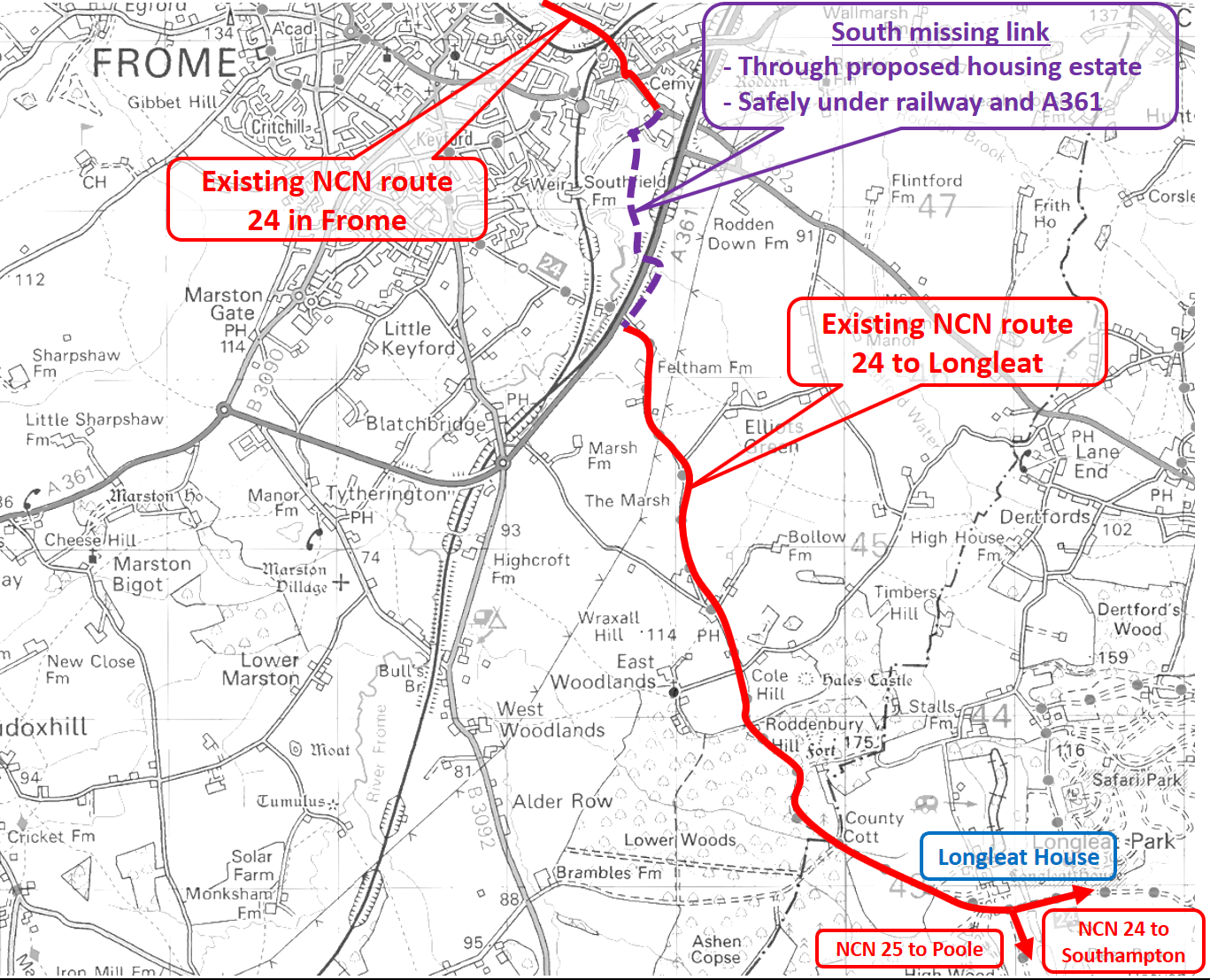
This overview map shows the route preferred by the group drawn from the local community and Sustrans.
· The route has been informally surveyed. Not all private landowners have been consulted at this stage, so no permissions should be inferred.
· This route depends on cooperation from Network Rail. Land acquisition is likely to be necessary.
· There are no significant structural issues or high cost associated with this route.
· The route is traffic free and suitable for novice or less confident cyclists, families and the mobility impaired.
Problems with the current route
· Heading south on Route 24 from Frome town centre currently involves climbing Locks Hill (up 43 metres over a short distance).
· After Locks Hill there is a further climb to the top of the Mount (up another 12 metres). We therefore have a 55 metre climb just to get out of Frome.
· Having descended Feltham Lane from the Mount, the potentially dangerous A361 Frome bypass has to be crossed.
Proposed route
· Connects directly with the riverside path between Willow Vale and New Road.
· Makes use of the existing cycle track to Asda.
· Shorter distance than the current route.
· The 55 metre Locks Hill/Mount climb is replaced by a gentler 14 metre climb to the top of the railway cutting behind Asda.
· The crossing of the railway and A361 Frome bypass makes use of existing farm bridges so is completely safe.
